Featured Image Credit: National Weather Service
A tropical storm watch has been issued across Texas and Louisiana as the 'Super El Niño' triggers its first major weather event, with the National Weather Service and the US National Oceanic and Atmospheric Administration both issuing warnings to millions of citizens.
Meteorologists have been warning about a developing Super El Niño for months, but now life-threatening conditions are already being reported across parts of the southern United States.
El Niño is a complex climate pattern characterised by warming of sea surface temperatures across the central and eastern Pacific Ocean, triggering a chain reaction of disrupted weather systems around the globe. With it, it brings varying rainfall patterns, intensifying storms, causing floods and droughts in regions that would not normally experience them.

Advert
The extended periods of unusually warm ocean temperatures could also threaten sea life and damage nearby ecosystems.
In 1877, a devastating El Niño event triggered one of the deadliest climate disasters in history.
The US National Oceanic and Atmospheric Administration (NOAA) has warned there is an 80% chance of a 'Super El Niño' developing by July and the early signs suggest it may already be underway.
Sea surface temperatures in the central and tropical Pacific have now crossed the critical 0.5C-above-average threshold that scientists use to define an El Niño event.
“El Niño conditions developed over the past month, as shown by above-average sea surface temperatures (SSTs) across the central to eastern equatorial Pacific Ocean,” NOAA confirmed in its latest warning.
Now, the National Hurricane Center has announced that the first named storm of the 2026 Atlantic hurricane season could form in the Gulf of Mexico within days.
Currently classified as a 'potential tropical cyclone' sitting approximately 360 miles (580 km) southwest of Lake Charles, Louisiana, the system is expected to intensify and potentially become Tropical Storm Arthur as it develops over the Gulf.
The system is reportedly generating maximum sustained winds of around 30 miles per hour (45 km/h), but its trajectory is causing concern for communities along the coast.
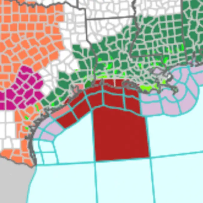
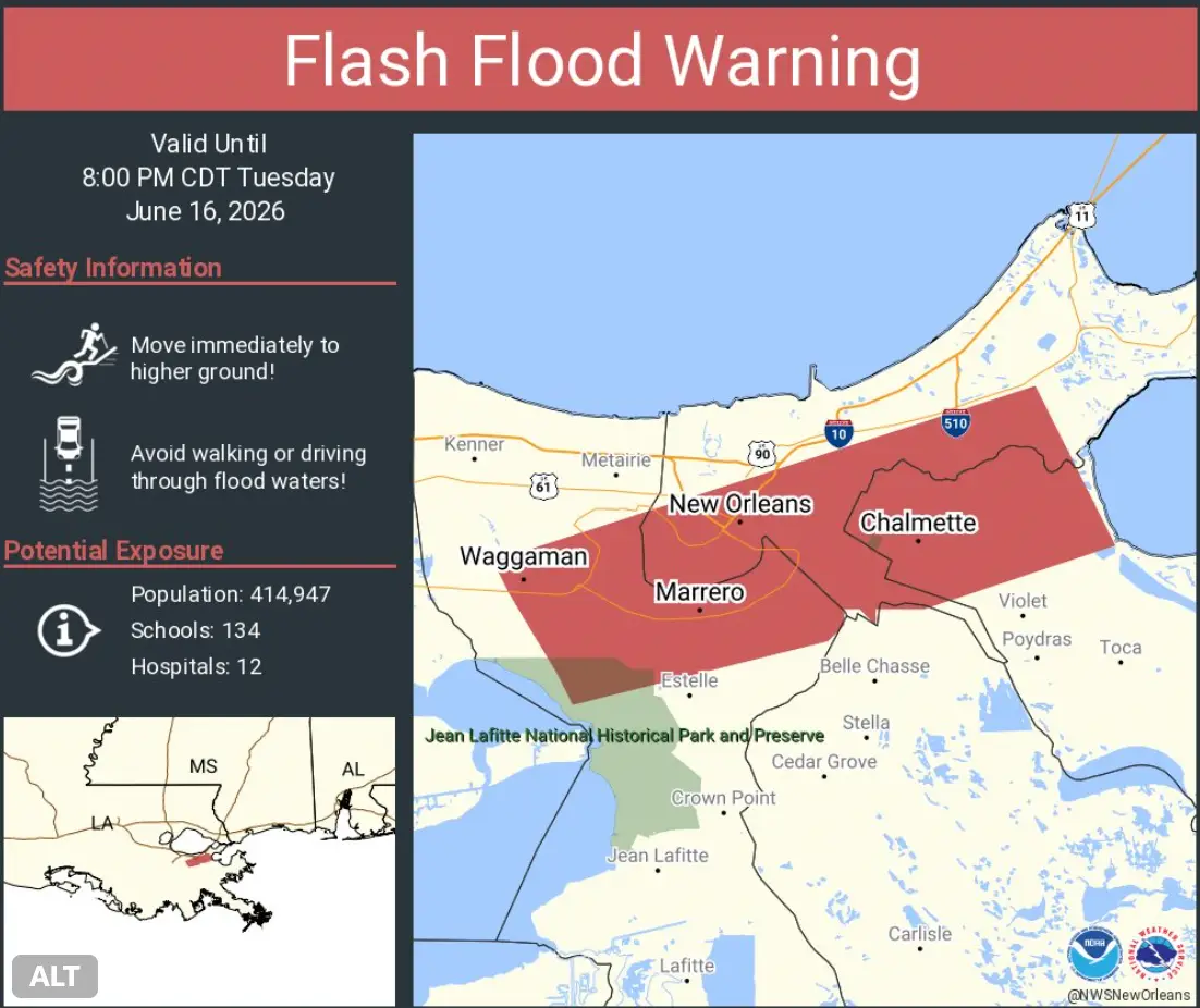
According to officials, residents along the Texas coast and eastward into central Mississippi could see life-threatening flash floods until Thursday, while tropical storm watches have been issued for the northwestern Gulf Coast from Sargent, Texas, to Morgan City, Louisiana.
Minor to moderate coastal flooding is also anticipated along parts of the Upper Texas and Louisiana coastlines, the National Hurricane Center reported.
“There is no one set of impacts," said Weston Anderson, a climate scientist at the University of Maryland (via Grist). Because El Niño touches such a 'diverse set of geographies' at the same time, the consequences vary dramatically from region to region. It's likely many places will experience disruption to their food supplies and economies into next year.