El Niño snow map reveals which US states could lose out on a white Christmas


Experts previously warned that global ocean temperatures had now reached an all time high, with signs that incoming the Super El Niño could be getting worse.
Now, it looks like the world is starting to see the real-time impacts of this extreme weather event, with states across the US expected to feel the effects.
This comes after a report by CNN suggested that the current El Niño is set to become a Super El Niño by October 2026, and is expected to become the strongest one on record by the end of the year.
As per the BBC, Professor Adam Scaife, who is the head of long-range forecasting at the UK Met Office, stated: “We should be clear that this is an unprecedented event. I have never seen an El Niño signal this intense in our forecasts.”
Advert
So, how will this impact the US over winter? Well, according to a report by Newsweek, this could mean that some states will be missing out on a white Christmas this year as data from the National Centers for Environmental Information (NCEI) appears to show that the most northern states are most likely to see snow in December, as well as Alaska, but the further south you venture, the less likely this becomes.
Speaking to Newsweek, AccuWeather meteorologist Peyton Simmers explained: “In a traditional El Niño pattern, the areas that favor a white Christmas are the higher elevations of the western states.
“December during traditional El Niños is typically warmer than the historical average, yielding a lower-than-historical-average chance for a white Christmas across the eastern United States.”
Will US States Lose Their White Christmas?
Certain US states risk losing their white Christmas because an El Niño can bring warmer-than-usual winter temperatures to parts of the country.
An El Niño occurs when surface waters in the central and eastern tropical Pacific Ocean become warmer than usual, with that excess heat changing atmospheric circulation, which then influences weather patterns across North America.
The states at risk of not having snow this Christmas include:
- Maine
- Minnesota
- New Hampshire
- North Dakota
- Vermont
What Triggers a Super El Niño?
A Super El Niño is essentially an unusually powerful El Niño, where strong atmospheric effects are triggered by the warming temperatures in the tropical Pacific Ocean.
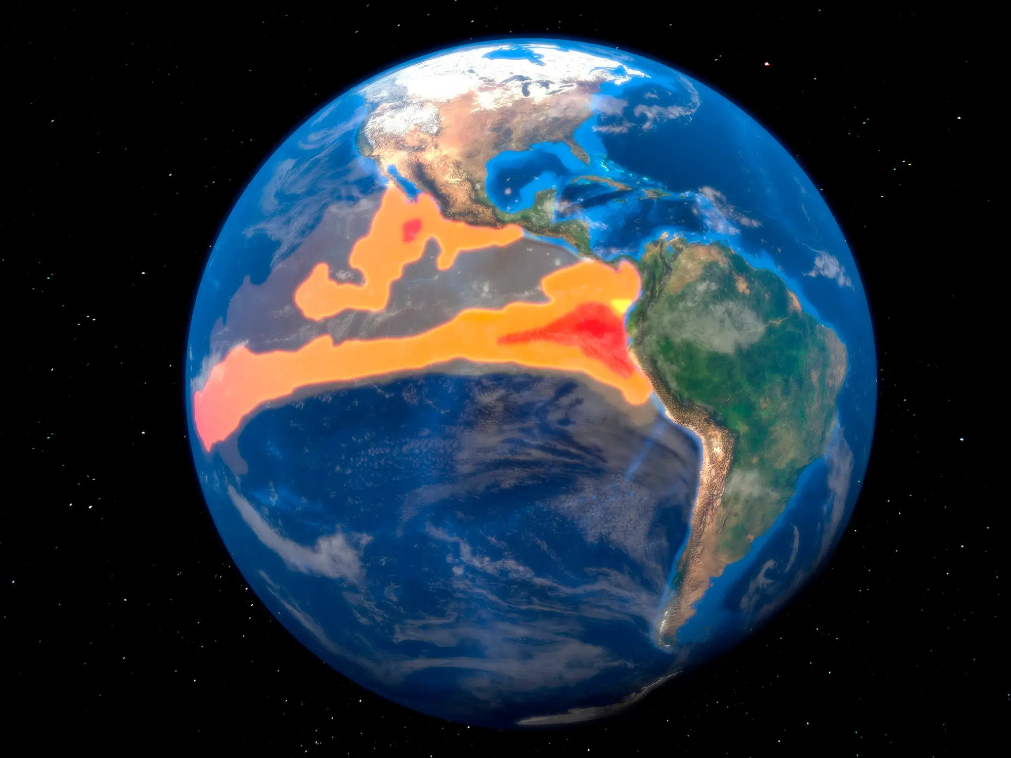
This leads to knock-on effects with weather globally, including the shifting of rainfall patterns, leading to floods and droughts in certain areas.
Back in 1877, the world suffered one of the deadliest climate disasters in recorded history when a massive El Niño event disrupted weather patterns across huge parts of the world.
This caused extreme drought in countries including India, China, Brazil and regions of Africa, with crops failing on a huge scale, rivers dried up and food shortages spiralled into famine.
Historians and climate researchers estimate the combined death toll from the global famines linked to the 1877 El Niño reached somewhere between 30 and 60 million people.
Researchers around the world now fear that another El Niño might push the planet into even more dangerous territory because global temperatures are already being supercharged by climate change.