NWS issue 'do not drive' warnings across five US states as dangerous conditions set to take hold

Weather officials have issued ‘do not drive’ warnings as destructive storms continue to batter parts of the US, with severe conditions expected to intensify across multiple regions.
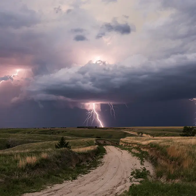
While there’s a ‘terrifying’ weather forecast set for in 20 years time — as of right now, flash flooding, damaging winds, large hail, and possible tornadoes are all being monitored as a fast-moving storm system pushes across the southern and central US.
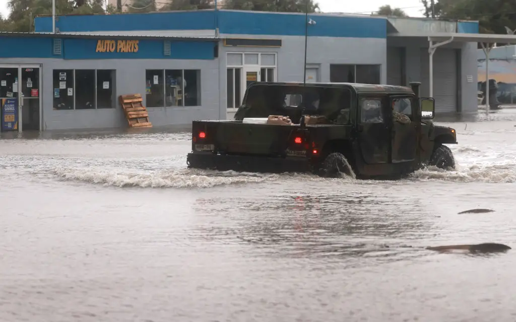
The warnings come amid growing concern that roads could quickly become unsafe, especially in areas hit by torrential rainfall over a short period of time.
Forecasters have urged residents to avoid unnecessary risks, with flooded roads posing one of the biggest dangers during severe weather outbreaks.
Advert
The National Weather Service has issued severe thunderstorm and flash flood warnings across Arkansas, Kansas, Louisiana, Oklahoma, and Texas.
As reported by the Daily Mail, the NWS warned in a statement: "Torrential rainfall is occurring with these storms, and may lead to flash flooding. Do not drive your vehicle through flooded roadways."
Parts of Arkansas, Louisiana, Oklahoma, and Texas had already recorded up to three inches of rain by Tuesday morning, with another four inches possible by noon local time.
The threat is not limited to heavy rain. In Kansas, storms are expected to bring wind gusts of more than 60mph, alongside hail nearly the size of golf balls.
Weather officials added: "Hail damage to vehicles is expected. Expect wind damage to roofs, siding and trees."
AccuWeather has warned that the risk of severe thunderstorms will also spread to Colorado, Nebraska, and southern Wyoming on Tuesday afternoon, with the wider storm system expected to continue through the night.
In addition to the damaging hail and flash flooding, isolated tornadoes could also touch down in the worst-hit storm areas.
Wind gusts on Tuesday and Wednesday could reach 85mph, equal to that of a Category 1 hurricane, AccuWeather meteorologists warned.
Among the areas being watched closely are Paris in Texas, Shreveport in Louisiana, and Norman in Oklahoma, where heavy downpours could rapidly make roads unsafe.
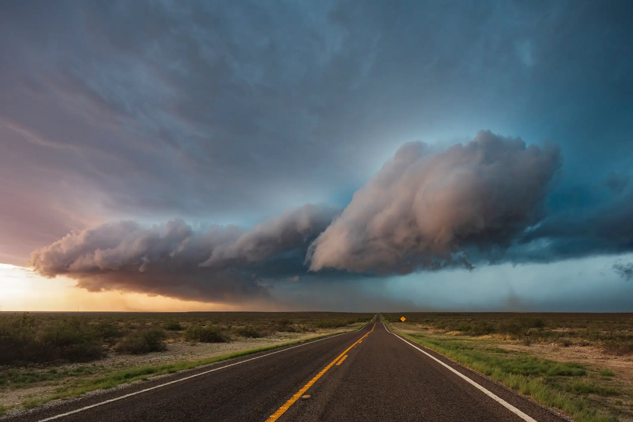
The system is also moving through parts of Texas and Louisiana, still recovering from the impact of Tropical Storm Arthur, raising the risk of further disruption in already-hit communities. Forecasters expect the severe weather threat to widen through the week as air moving up from the Gulf Coast helps feed storms developing out of the Rockies.
That combination can create the conditions needed for more complex and dangerous thunderstorms, including systems capable of producing large hail, destructive wind gusts, and tornadoes.
By Wednesday, the risk zone is expected to include New Mexico, Mississippi, Alabama, southern Missouri, and the Florida Panhandle.
AccuWeather Meteorologist Alex Duffus said in a statement: "The focus of severe thunderstorms will shift into the northern Plains and Midwest this weekend. Thunderstorms in this region will pose the risk of damaging winds, hail and even a few tornadoes."
The NWS has urged people in affected areas to take shelter away from exposed parts of buildings, adding: "For your protection stay inside a sturdy structure and keep away from windows,"
However, officials have put particular emphasis on the danger facing motorists, with floodwater remaining one of the biggest risks during severe rain events.
Even shallow-looking water can hide damaged road surfaces, debris, or strong currents, while conditions can worsen before drivers have time to react.
The agency warned: "Turn around, don't drown when encountering flooded roads. Most flood deaths occur in vehicles."