Featured Image Credit: YouTube/@NASAGoddard
Many people have likely heard the term ‘El Niño’ being used during extreme weather moments such as heatwaves, floods or during hurricane season.
However, with public concerns growing about a ‘super’ El Niño being on the horizon, interest in the phenomenon has also increased.
And now, many people have been left fascinated after NASA released 3D footage of the last time the world experienced such an extreme weather event.
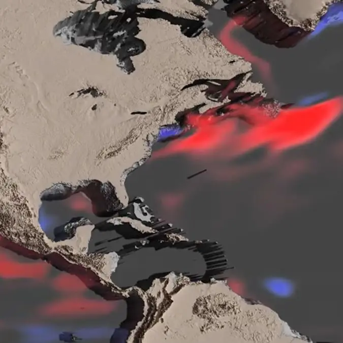
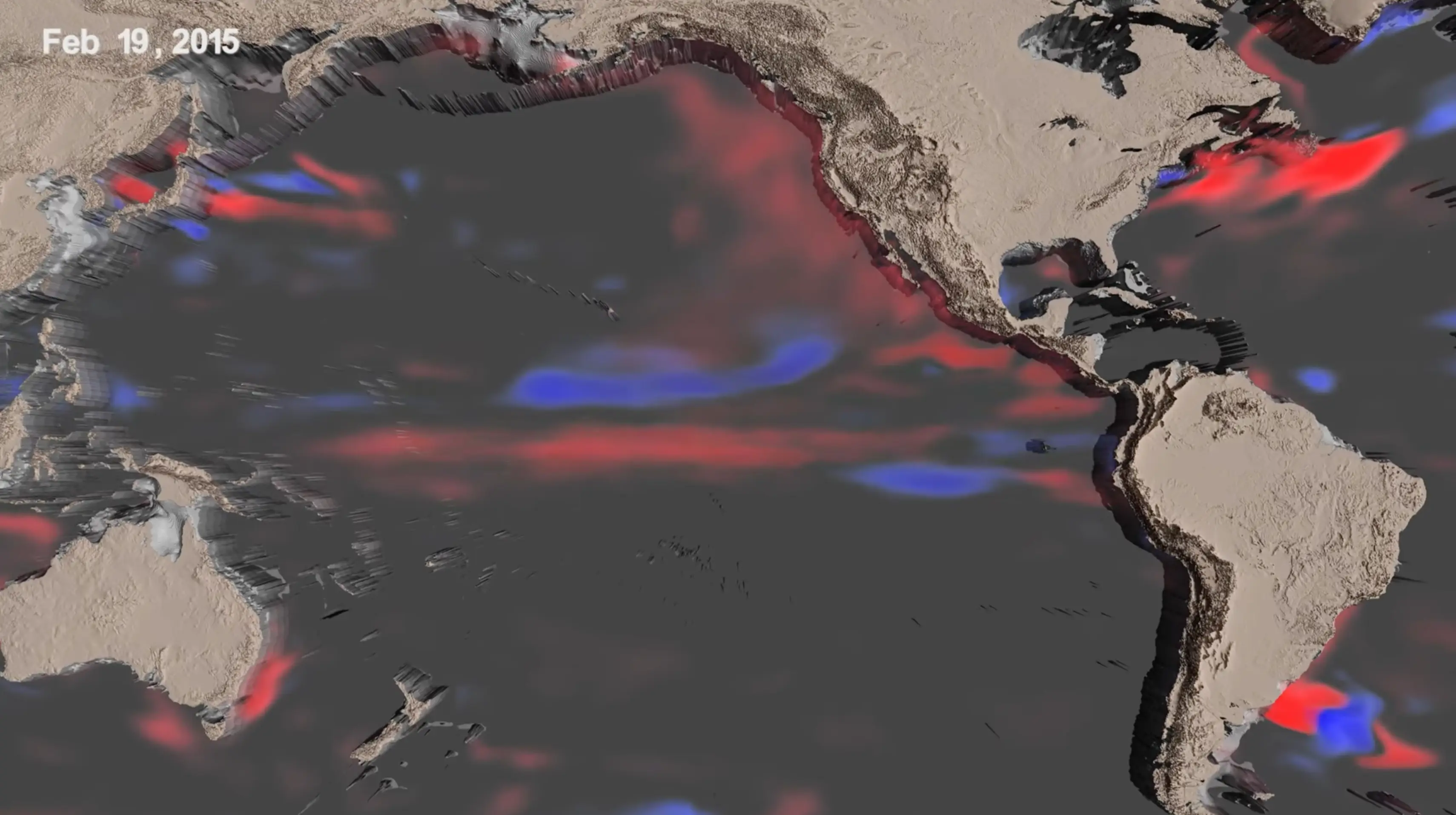
The clip was posted to YouTube, and in the video description, NASA explained: “Two back-to-back 3-D visualizations track the changes in ocean temperatures and currents, respectively, throughout the life cycle of the 2015-2016 El Niño event, chronicling its inception in early 2015 to its dissipation by April 2016. Blue regions represent colder and red regions warmer temperatures when compared with normal conditions.”
Advert
The space agency continued: “The first visualization shows the 2015-2016 El Niño through changes in sea surface temperature as warmer water moves east across the Pacific Ocean. The Eastern Pacific Ocean undergoes the most warming from July 2015 to January 2016.
“In the west, just to the north of the equator, cooler waters hit the western boundary and reflect along the equator and then head east starting in February 2016. Just as the warming waves traveled east earlier in the video, these cool waters make their way to the central Pacific, terminating the warming event there.”
An El Niño is a complex climate pattern which involves the warming of sea surface temperatures in the central and eastern part of the Pacific Ocean.
When this happens it leads to knock-on effects with weather globally, including the shifting of rainfall patterns, leading to floods and droughts in certain areas.
There are concerns that a new ‘super El Niño’ could be brewing with weather forecasters at the US National Oceanic and Atmospheric Administration (NOAA) warning that there is an 80% of one developing by July of this year.
Speaking to AFP, Adam Scaife, who is the head of long-range prediction at the UK Met Office, said: “There’s definitely something coming. We’re very confident about that, and it looks like it will be a big event.”
Back in 1877, the world suffered one of the deadliest climate disasters in recorded history when a massive El Niño event disrupted weather patterns across huge parts of the world.
This resulted in extreme drought in countries including India, China, Brazil and regions of Africa, with crops failing on a huge scale, rivers dried up and food shortages spiralled into famine.
Historians and climate researchers estimate the combined death toll from the global famines linked to the 1877 El Niño reached somewhere between 30 and 60 million people.
However, this does not mean that the world would suffer the same fate if a similar weather event happened today, as scientists have stressed that today’s forecasting systems and disaster response networks are far more advanced than they were during the 19th century, making a death toll on the scale of the historical famines far less likely.