Featured Image Credit: Handout / Handout / Getty
A state of emergency has been declared in parts of the US as Hurricane Erin's barrels toward the mainland.
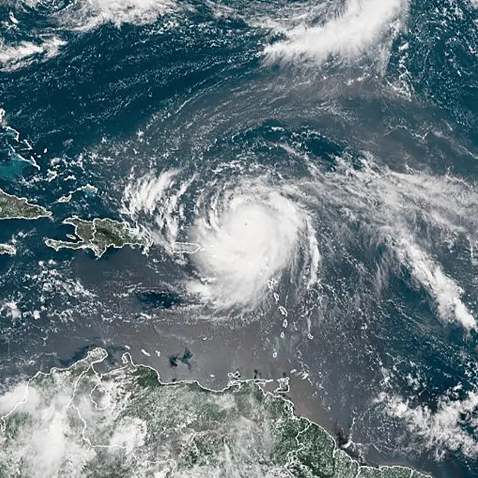
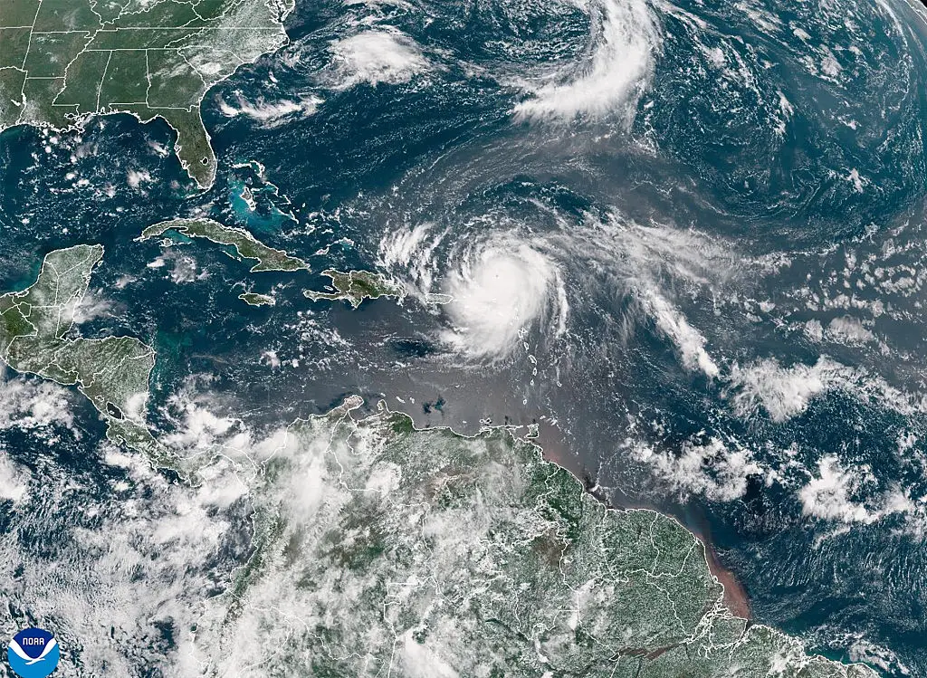
The massive Category 4 storm is currently positioned about 951 miles south-southeast of Cape Hatteras, moving northwest at 13 mph with maximum sustained winds of 130 mph.
Erin briefly intensified to Category 5 status on Saturday, which could bring life-threatening conditions and dangerous rip currents.
Now, North Carolina officials have declared a state of emergency and ordered mandatory evacuations for multiple coastal areas.
Advert
Dare County, which is home to more than 38,000 residents, began evacuations at 10 am Monday (18 August), while officials have cleared Hatteras Island including the villages of Rodanthe, Waves, Salvo, Avon, Buxton, Frisco, and Hatteras.
"You're dealing with a major hurricane. The intensity is fluctuating," said Richard Pasch of the NHC. "It's a dangerous hurricane in any event."
The National Hurricane Center warns that beaches along the Outer Banks could see waves reaching 20 feet starting Tuesday (19 August) as well as flooding, beach erosion, and wind gusts of 20 to 40 mph.
"Now is the time to secure property, finalize plans, and evacuate with belongings," officials wrote on Facebook. "Please follow instructions from officials and property managers."
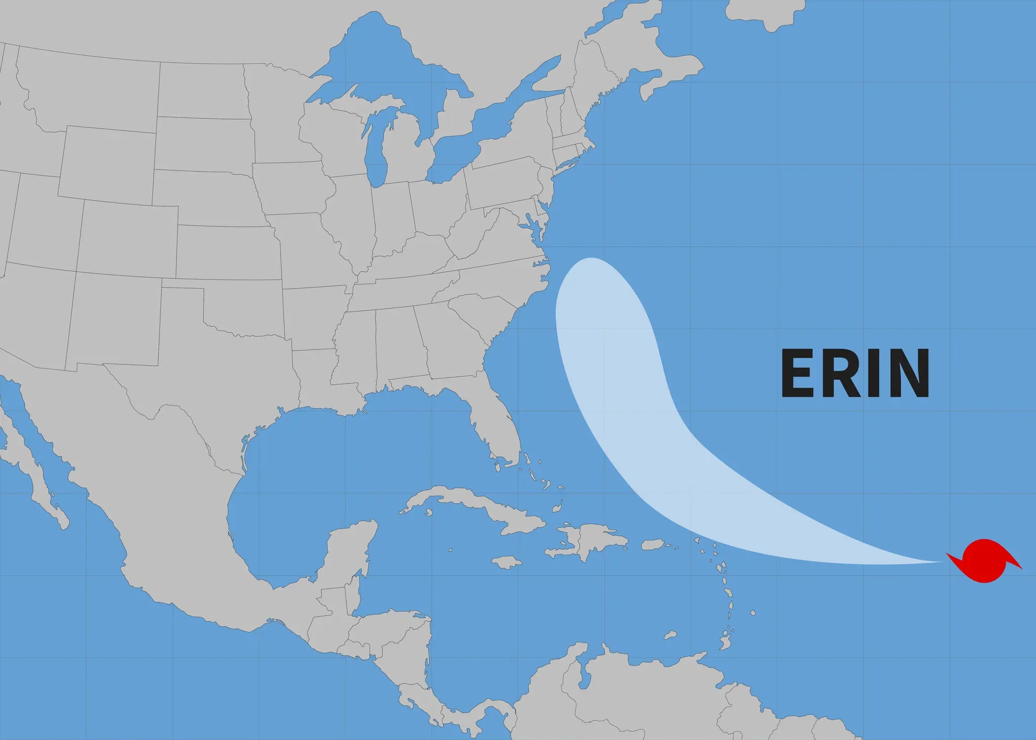
The storm is expected to affect the Tri-State Area from Tuesday through Thursday, mainly targeting the Jersey Shore and Long Island's South Shore.
Hyde County has also declared an emergency for Ocracoke Island, with visitor evacuations beginning at 8 pm Sunday and resident evacuations scheduled for 6 am Tuesday.
"While Hurricane Erin is expected to stay well off our coast, the system will continue to increase in size and is forecast to bring life-threatening impacts to the Ocracoke coastline and render Highway 12 impassable," explained Donnie Shumate, Hyde County Public Information Officer.
As of Monday morning, Erin was positioned about 105 miles north-northeast of Grand Turk Island. The NHC expects the storm to make a gradual turn northward Monday into Tuesday.
Erin's outer bands have already impacted Puerto Rico and the US Virgin Islands with heavy rain and tropical-storm-force winds on Sunday. The storm knocked out power for roughly 147,000 customers and forced the cancellation of more than 20 flights.
Meanwhile, the Bahamas government has issued a Tropical Storm Watch for the central Bahamas, while warnings remain in effect for the Turks and Caicos Islands and southeast Bahamas.
"Even though some weakening is forecast beginning Monday night, Erin will remain a large and dangerous major hurricane through the middle of the week," the NHC added.