Featured Image Credit: Google Earth
Antarctica has become a hotspot for conspiracy theories in recent times, well more than usual anyway.
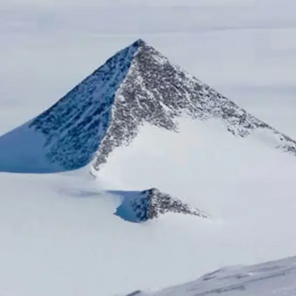
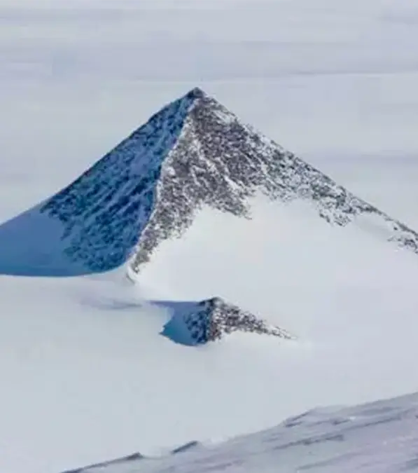
First, there were the 'bleeding waterfalls' and now there's a mysterious triangle that looks almost like a 'pyramid' that's visible in the polar region.
Its pointed top and familiar structure can be spotted from Google Earth's aerial view.
Social media have been scratching their heads over the intriguing supposed-monument: how has a pyramid that looks straight out of Egypt been placed in somewhere like unhabitable Antarctica?
Advert
One X user theorised: 'This structure belongs to the civilization which existed before the flood. Around 10,000 years ago Antarctica was warm.'
Another plainly wrote: 'illuminati confirmed.'
'Wait how they moved the pyramids from Egypt to Antarctica?' one user asked.
Well, the answer is it's actually not a pyramid at all - It's a mountain poking out the top of ice.
It's located in the Ellsworth Mountains which are the highest mountain range in Antarctica which were discovered by the British Antarctic Expedition of 1910 - 1913.
Geologist at the German Research Centre for Geosciences in Potsdam, Dr. Mitch Darcy, said: 'The pyramid-shaped structures are located in the Ellsworth Mountains, which is a range more than 400 km long, so it’s no surprise there are rocky peaks cropping out above the ice. The peaks are clearly composed of rock, and it’s a coincidence that this particular peak has that shape.
'It’s not a complicated shape, so it’s not a special coincidence either. By definition, it is a nunatak, which is simply a peak of rock sticking out above a glacier or an ice sheet. This one has the shape of a pyramid, but that doesn’t make it a human construction.'
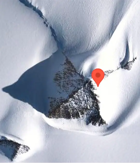
If you want to take a look at the curious tundra structure yourself on Google Earth, the coordinates are 79°58’39.25"S 81°57’32.21"W - located in an area known as the 'Heritage Range.'
According to Professor Eric Rignot of the University of California: 'This is just a mountain that looks like a pyramid.
'Pyramid shapes are not impossible - many peaks partially look like pyramids, but they only have one to two faces like that, rarely four.'
So there you have it, not so crazy after all.