Diver shows what really lies within mysterious 'hole' completely blacked out of Google Maps
If you've ever had time to spare and gone down a Google Maps rabbit hole, you'll be surprised at just what you might find. You can look at exotic beaches, interesting places or sites you might want to visit one day.
In 2021, Google Maps even announced it would begin showing drivers more eco-friendly routes as part of efforts to cut carbon footprints.
But you may also stumble across some anomalies - like places completely blacked out or blurred out on Google Maps, because they are classified, or people want privacy.
Advert
Now, a video from National Geographic, from as far back as 2009, may just have uncovered 'the truth' behind one of those mysterious, 'blacked out' spots on Google Maps.
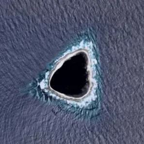
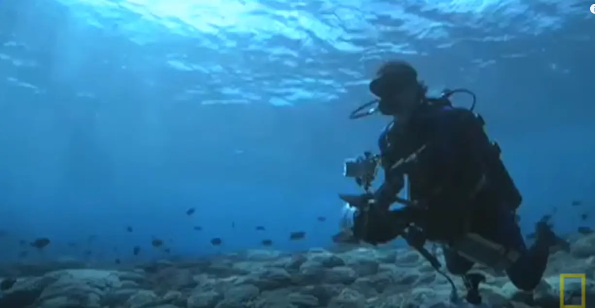
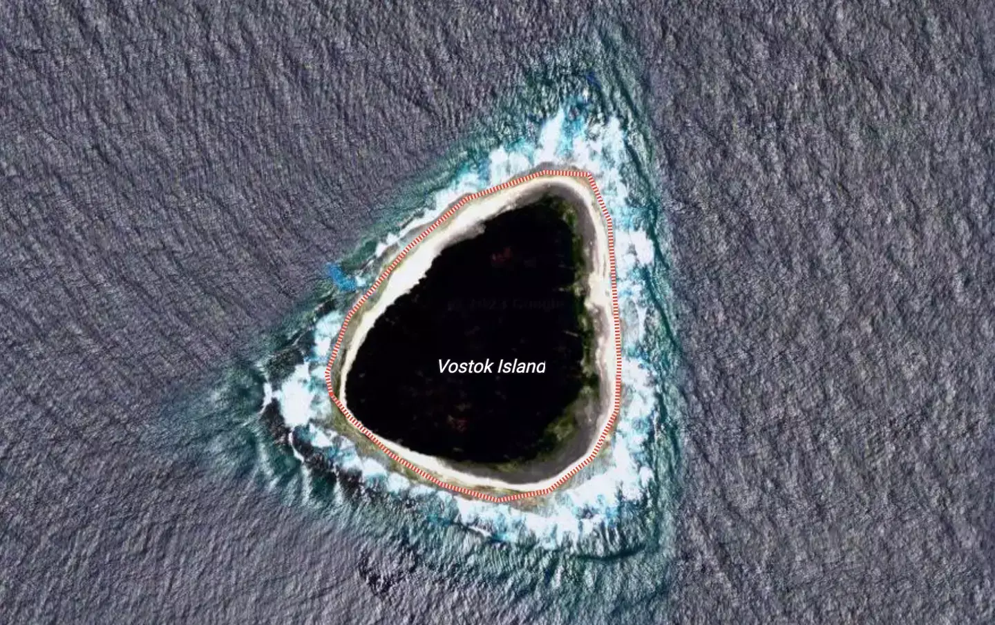
Showing a clip of conservationist Enric Sala, it features footage of him diving at Vostok Island - the exact place that sparked many questions for social media users due to it being a 'black hole' on Google Maps.
The clip shows Sala saying he's just had 'one of the best dives' of his life after exploring Vostok's coral reefs.
He says: "Well, we just came back from a dive on Vostok Island. I just did the very best dive of my life."
"There were... sharks around us, schools of jags, barracuda and surgeon fish, everything!"
"Incredible! Really unbelievable. This is the most pristine place we have dived so far. We have found it, this is it. Vostok Island."
"I cannot wait for tomorrow to get back in the water".
Back in 2021 Vostok Island was 'unmasked' by eager social media users, hence the video surfacing again too. And the island is in fact not a 'top secret' or clandestine destination at all, but rather an uninhabited island in the central Pacific Ocean, and is part of the Line Islands belonging to Kiribati.
The island looks to still be 'blacked out' on Google Maps, even though its identity is now confirmed.
Comments under the National Geographic YouTube video included someone saying: "So this island is now getting famous because google maps blacked it out", while another said: "12 years later, the internet rediscovers this island because it looks a bit dark on Google Maps."
A Google Maps Reddit thread (admittedly also from two years ago) with the headline: 'The real Vostok Island - No it's NOT a black hole!' and a picture alongside it had people posting their theories too.
One person wondered: "Has it been blacked out to hide something that’s on the island now? Like military, or maybe something that washed up on the island?".
Someone else said: "Why are these pictures not available on google earth pro? There are only two pictures available, one is the typical blurred image of 1985 that the whole world has, and the other one is from 2009, and it's from the time it looked like a black hole."
Comparisons to JJ Abrams' 2004 series Lost, where people are stranded on an island 'somewhere in the South Pacific', have also been made.