Featured Image Credit: introductionDue7945 / Reddit
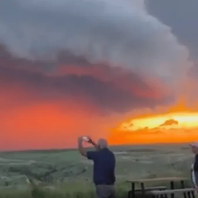
Dramatic video of a massive storm system has gone viral with its apocalyptic appearance.
Summer weather can be unpredictable, but what happened in South Dakota last month left even experienced weather watchers absolutely speechless.
While most people expect typical summer storms with some rain and thunder, residents of the Great Plains state witnessed something that looked more like a scene from a disaster movie.
A massive supercell thunderstorm transformed the South Dakota sky into a 'doomsday scenario'.
Advert
Footage captured by onlookers shows massive, spiralling clouds glowing with a strange red light, making the whole sky look like it was burning.
One person shared the crazy storm on Reddit with the caption: "A supercell thunderstorm".
The massive storm system stretches across the horizon, creating a wall of churning clouds that seems to go on forever.
"Looks like doomsday is upon you! So cool," one social media user commented.
"so spooky but so gorgeous," wrote another Reddit user, while someone else added: "The bombshell carousel raising hell."
According to a meteorologist at Keloland, since 2000, South Dakota averages 26 tornado reports, 362 severe wind reports (winds of 57 mph and greater), and 355 severe hail reports annually.
So while severe weather is not uncommon in the state, supercells of this magnitude are relatively rare occurrences that can go years between appearances.
The Great Plains location makes South Dakota particularly susceptible to severe weather because it sits at the intersection of different air masses.
Warm, moist air from the Gulf of Mexico collides with cool, dry air from Canada, creating the perfect conditions for explosive storm development.
Over on Facebook, someone provided some context to the so-called 'weather warfare' storm where it was apparently filmed 'looking at it from the South in Pierre, SD 6/27/2025.'
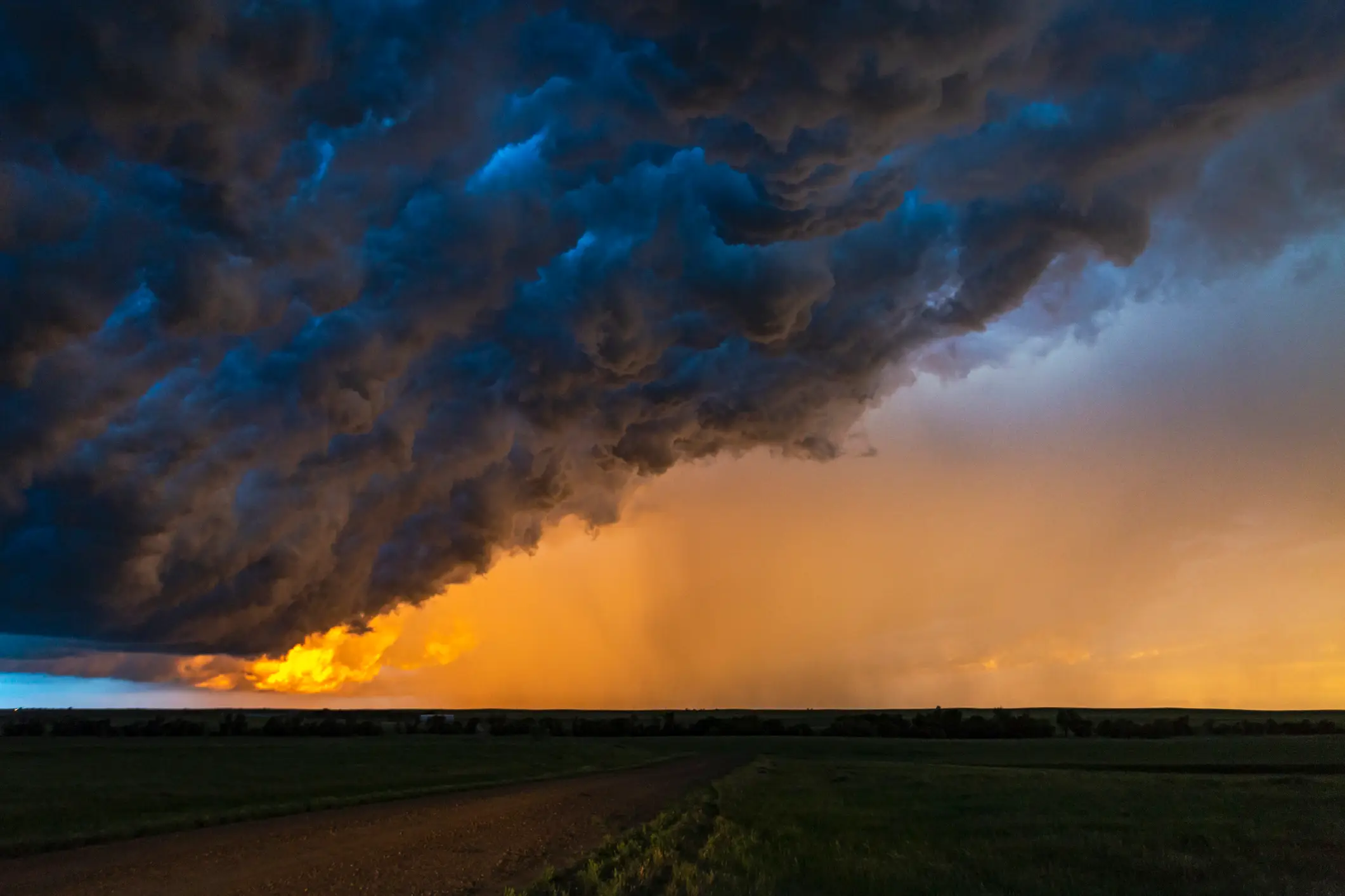
According to weather reports, during the afternoon of 28 June 2025, a supercell from southeastern Montana tracked into western South Dakota, bringing with it devastating conditions.
The storm produced winds exceeding 80 mph and hail ranging from tennis ball to softball size, causing significant damage to crops and farm equipment across the region.
At various points, the storm showed signs of tornado development and prompted multiple tornado warnings from the National Weather Service.
As the storm system approached the town of Kadoka, it spawned an actual tornado in the White River Valley area. This tornado was later classified as an EF-2, indicating winds between 111-135 mph. The twister caused two injuries and inflicted substantial damage to buildings and trees in its path.