uniladtech homepage
  • News
    • Tech News
    • AI
  • Gadgets
    • Apple
    • iPhone
  • Gaming
    • Playstation
    • Xbox
  • Science
    • News
    • Space
  • Streaming
    • Netflix
  • Vehicles
    • Car News
  • Social Media
    • WhatsApp
    • YouTube
  • Advertise
  • Terms
  • Privacy & Cookies
  • LADbible Group
  • LADbible
  • UNILAD
  • SPORTbible
  • GAMINGbible
  • Tyla
  • FOODbible
  • License Our Content
  • About Us & Contact
  • Jobs
  • Latest
  • Archive
  • Topics A-Z
  • Authors
Facebook
Instagram
X
TikTok
Snapchat
WhatsApp
Submit Your Content
People left feeling deeply unsettled after seeing incredibly rare angle of Earth on Google Maps

Home> News

Updated 10:21 7 May 2025 GMT+1Published 10:22 7 May 2025 GMT+1

People left feeling deeply unsettled after seeing incredibly rare angle of Earth on Google Maps

'The side of planet Earth we aren't used to seeing'

Rebekah Jordan

Rebekah Jordan

google discoverFollow us on Google Discover
Featured Image Credit: DrPixel via Getty
Earth
Social Media
Space
Google
Twitter

Advert

Advert

Advert

A rare image captured of planet Earth is giving people a whole new perspective - and it’s making some viewers a little uneasy.

Google Maps has always been a pretty darn useful tool for showing us the world from a whole new angle. Whether it’s opening up new clues for conspiracy theorists at Area 51, piecing together some of the world’s most disturbing mysteries, or just providing some innocent humour, the internet is a wonderful place at times.

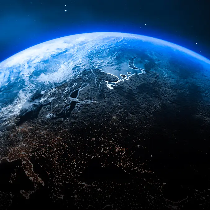
As we know, about 71% of our planet's surface is covered by water. But most of the land we’re familiar with is packed into the northern hemisphere, where you'll find large continents like North America, Europe, most of Asia, Africa and parts of South America.

So, it came as a shock to many on social media when one Google Earth photo showed nothing but the vast, empty stretch of the Pacific Ocean. It's almost as if someone has Photoshopped all the landmass away, leaving just one big, blue planet.

Advert


X user @AMAZlNGNATURE posted the screenshot from Maps, alongside the caption: "The side of planet Earth we aren't used to seeing."

In the image, water takes up nearly the entire frame, with just a tiny speck of land from New Zealand in the lower left corner and a bright white glimpse of Antarctica at the bottom. The only other patches of white in the image are clouds and weather systems, scattered across the ocean like you would expect.

So why does this angle look so strange?

Well, the side we're looking at is the Southern Hemisphere, which is made up of around 89% ocean and only 11% land. Aside from New Zealand and Antarctica, there are a few other places that are there, just not visible in this image.

An image of planet Earth many of us are used to seeing. (Roberto Machado Noa/Getty)

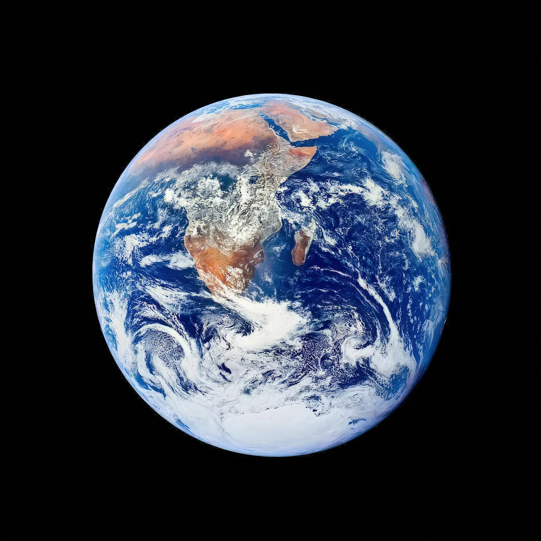
There are also the Hawaiian Islands, Fiji, Tonga, Samoa, and some Polynesian, Melanesian, and Micronesian islands, including French Polynesia, Easter Island, and the outer edge of the Galápagos Islands.

Over on social media, mixed reactions have been pouring in.

"Always wondered why we call it “Earth” when it 2/3rds water," one person commented.

"The more I look at this the more I believe we live in a simulated world," wrote another.

"The back of Earths head is crazy," someone else claimed.

Meanwhile, Kiwis were just glad to see themselves represented for once, replying: "Speak for yourself. Hello from New Zealand!" whilst another chimed in: "Finally a map with New Zealand in it".

Choose your content:

8 mins ago
an hour ago
18 hours ago
  • Alex Wong / Staff / Getty
    8 mins ago

    Why metadata could be the ultimate snitch for Melania Trump when it comes to the Epstein files

    It's harder than ever to escape your digital footprint

    News
  • Bravo
    an hour ago

    Real Housewives star reveals disgusting job former billionaire Elizabeth Holmes has to perform in prison

    It's a 'crap' job, but someone's got to do it

    News
  • Tero Vesalainen via Getty
    18 hours ago

    Ohio man becomes first in history to be convicted of creating 'sexually explicit images' using AI

    New legislation is used for the first time in a major case

    News
  • Matt Cardy / Contributor via Getty
    18 hours ago

    Why gamers could be first on the list for draft if WW3 breaks out

    Those MW2 lobbies might actually pay off

    News
  • Google Maps users spot disturbing 'face' on mountain top in Chile located on a remote island
  • Bizarre triangle in desert spotted on Google Earth sparks eerie 'lost civilization' theories
  • Google Earth captures 'horrifying' transformation of the planet over 3 decades and the difference is sobering
  • Emotional Google Maps trend leaves users 'physically hurting' after trying out little-known hack